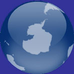
Map of Antarctica
Map of Antarctica > Antarctica History | Antarctica Travel Tips |
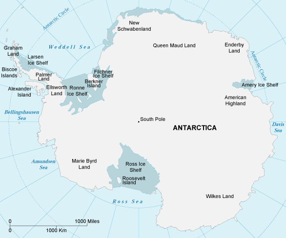
Antarctica Political Map
Antarctica has no permanent residents, although explorers and scientists often call it home for short periods of time. Seven nations claim different sectors of the continent, but the 1959 Antarctic Treaty forbids any military activities and reserves Antarctica for free and nonpolitical scientific study. Diversified ongoing research is conducted by several thousand scientists of many nationalities.
Antarctica supports a small number of land plants as well as large seabird rookeries which feed on the rich offshore food supply. The various flightless penguin species are perhaps the most famous inhabitants, and Antarctic krill are an important food source for many other species. Bounded on the north by the Atlantic, Indian, and Pacific Oceans, the cold Antarctic continent is covered by a permanent ice cap which, in some places, is over 10,000 feet thick! Antarctica plays a very important role in the Earth's ecology: it is home to 90 percent of the world's ice and 70 percent of its fresh water. Antarctica has much to do with our planet's climate, playing a major role in the circulation of ocean currents and atmospheric winds.
 |
What Does Antarctica Look Like?
Many people liken Antarctica to an open fan, with the Antarctic Peninsula representing the fan's handle. Basically, the continent is a vast, snow-covered desert, with mountain ranges near the coasts. The average elevation is 6,000 feet, with elevations reaching about 16,000 feet at Vinson Massif in the Ellsworth Mountains.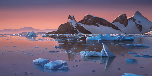 |
The Future of Antarctica
Like much of the planet, Antarctica appears to be affected by a long term global warming trend. Ice shelves along the Antarctic Peninsula have broken up, and higher than normal temperatures have caused breeding disturbances among Adelie penguins.
Antarctic Travel and Tourism > Antarctica Travel Destinations
Tourism in Antarctica is primarily by ice-strengthened passenger ships, carrying between 50 and 300 passengers. These cruises sail primarily to the Antarctic Peninsula region as well as South Georgia and the Falkland Islands. Additional Antarctic travel information is available from Cool Antarctica.
Bibliography
- Chester, J. (1991). Antarctica: Beauty in the Extreme. Philadelphia: Running Press.
- Hook, P. (2006). The Frozen World. London, UK: Compendium Publishing.
- McGonigal, D. (2008). Antarctica: Secrets of the Southern Continent. Richmond Hill, Ontario: Firefly Books.
Related Continent Map Sites
- Map Of Africa - Africa maps.
- Map Of Australia - Australia maps.
- Map Of South America - South America maps.
All rights reserved. About us.
Antarctica map is © Map Resources.